The IPCC’s Land Report: What’s in it for Latin America
The IPCC’s Land Report: What’s in it for Latin America
What’s in it for Latin America? presents key findings from the IPCC’s Special Report on Climate Change and Land (SRCCL) for Latin America. It extracts Latin America-specific data, trends and analysis directly from SRCCL, summarising it in a short volume to make it accessible to all audiences, and highlights key opportunities to achieve adaptation, mitigation and development.
The report’s full name is Climate Change and Land, an IPCC special report on climate change, desertification, land degradation, sustainable land management, food security, and greenhouse gas fluxes in terrestrial ecosystems. It is one of three special reports that the IPCC is preparing during the current Sixth Assessment Report cycle.
The report was prepared by 107 experts from 52 countries (with a majority of authors from developing countries) and spans more than 1,500 pages. Now, the Climate and Development Knowledge Network has released a succinct guide to the Special Report for decision-makers in Latin America.
Latin America Land Toolkit
Alongside the What’s in it for Latin America report, CDKN presents a ‘Communications toolkit’, a bundle of resources freely available for training, educational and reporting purposes, to encourage understanding of the report worldwide.
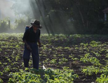
This image shows a farmer spraying his land in Bolivia
Courtesy of Thomas Mueller/SPDA
Presentation of key results of the IPCC report on Climate Change and Land and what means for Latin America
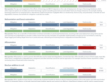
An infographic showing climate actions that increase competition for land, including bioenergy with carbon capture and storage, reforestation and forest restoration, afforestation and biochar addition to soil, and 'best practices' that can reduce the pressure.
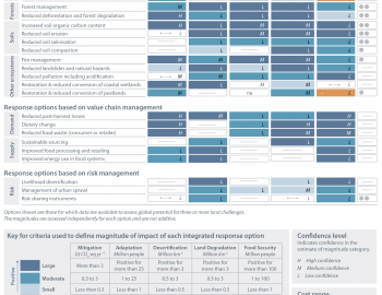
An infographic showing the positive and potential negative impacts of actions that minimise pressure on land.
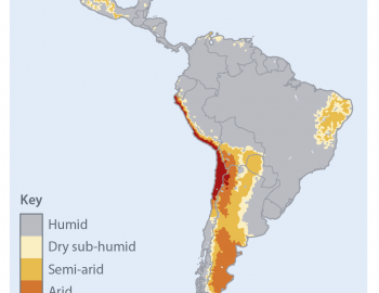
Geographical distribution of drylands in Latin America, delimited based on the aridity index (AI).
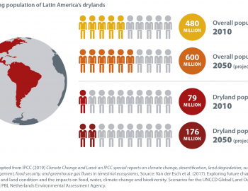
An infographic showing the current and projected population growth in Latin America's drylands.
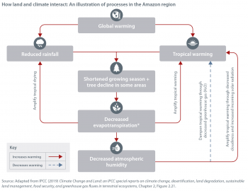
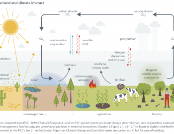
An infographic showing how changes in land cover interact with the climate on a regional scale, in the Amazon.
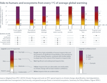
An infographic showing the risks to food systems, livelihoods, infrastructure, the value of land, and human and ecosystem health from every 1°C of average global warming.
An infographic showing how land can be both a source of greenhouse gas emissions, and a sink for emissions.

